
GPS Navigation on your Bike Touring Adventure is simple and well organised. We use a combination of GPS units and paper map sheets so you are covered for all occassions.
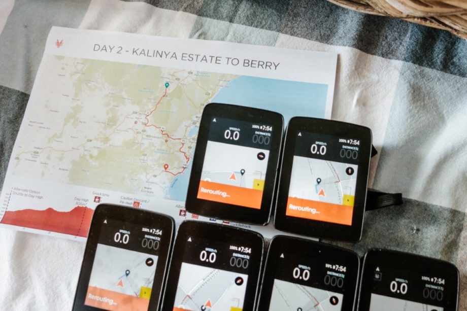
Map sheets for the entire Odyssey will be given to you all on Day 1. Each page for each day on tour has a summary of what to expect – map, route, elevation profile, items of interest, important daily details and things to watch out for. Your guides will be going through these with you each evening over an aperitif for the day ahead.
GPS navigation can be with our Hammerhead Karoo units or with your own unit. For those using our GPS units, they’ll be loaded with the routes and ready for you to use when we see you on tour. For those of you that are unfamiliar with the workings of cycling GPS units (ours or yours) and how they work, don’t worry, we’ll walk you through it at the start of the tour.
We have found that the GPS computers have really improved the tour experience in that they allow you the freedom to take in your surroundings far more than you ever could with route notes. We do have paper route notes for you too, but more for your perusal over brekky and as a backup in your pocket. Our Hammerhead Karoo GPS units are the latest and greatest and we have been working closely with Hammerhead, as their first cycle touring group to use them, since they started production in 2018. These units are a combination between a bike GPS unit and a smartphone so the screen clarity and user experience is top notch
For those using their own GPS units. There are a few ways to access the routes depending on your device.
- For Wahoo, we will share a Ride with GPS event with you which you can connect to with you phone and device.
- For Garmin, we will share the routes as .tcx files. We use .tcx as they allow us to add custom cues such as coffees, lunch locations and high points.
Most GPS devices also require (or at least function better) with underlying maps. The above routes will give you directions and line to follow. The underlying maps will give you the streets, terrain and maps to see where you are in the world.
In the past you would have to buy these maps and they are still sold by Garmin and other companies. However, they are also freely available online. Again, if you are using our Karoo devices, they will have the maps loaded and ready to go. If you need maps there are few great free resources online from where you can download maps for free.
Try http://garmin.openstreetmap.nl/ or https://garmin.opentopomap.org/. Follow the instructions on the websites, but essentially you download a .img file for the required country or countries and copy it into the /Garmin folder on your SD card in your device. You can also copy it directly into the same folder on the device itself but it is preferable to do it on the sd card.
If you have any trouble get it touch and we will be happy to help on tour to get your device setup perfectly!