

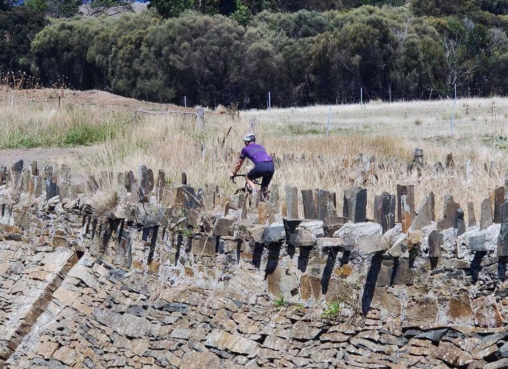
What history lies beneath Tasmania’s roads? Two stories, laid one over the other. The deeper one is at least 35,000 years old: the palawa, Tasmania’s Aboriginal people, who walked here across a land bridge during the last Ice Age and lived at the edge of the glaciers as the southernmost humans on Earth. The newer one is barely two centuries old and far darker: Van Diemen’s Land, the British Empire’s most feared convict colony, and the frontier war that came close to destroying the people who were already here. Ride Tasmania – UnderDownunder from Hobart and back and you cross both stories nearly every day, often on the same stretch of road.
I’m an archaeologist by training, and I have spent most of my working life chasing history by bike – Hannibal across the Alps, Richard the Lionheart through Europe, the Allies through Normandy. But I’ll admit Tasmania surprised me. Nowhere else we ride packs so much time into such a small island, and nowhere else do we have a historian who personally helped dig it out of the ground.
Our Historian Was There: Richard Cosgrove
Richard Cosgrove – Cosi to everyone on tour – was born in Launceston, learned to ride on an old steel single speed, and went on to study archaeology at the Australian National University. After a Master’s on the Aboriginal archaeology of the north Queensland rainforests he came home to Tasmania as an archaeologist with the National Parks and Wildlife Service, and in the 1980s he was on the Franklin and Gordon River field expeditions, sent in to assess the cultural heritage of a wilderness the Tasmanian Government planned to drown under a hydro-electric dam.
What those expeditions found changed Australian history. Limestone caves, deep in the rainforest, packed with the stone tools and food debris of people who had lived there during the Ice Age. Richard took that experience into a PhD at La Trobe University on the Ice Age occupation of southwest Tasmania, completed in 1992, and then spent more than 30 years teaching and researching archaeology there, with projects in Tasmania, the Kimberley, the Queensland rainforests, China and France.
So when Richard tells you, standing in the buttongrass, that the people of this island were not isolated, dwindling survivors but skilled, systematic hunters who thrived here for tens of thousands of years, he is not reciting a guidebook. He is telling you what he and his colleagues found.
40,000 Years Under the Buttongrass: Lake St Clair, the Franklin and Queenstown
Days 3 and 4 take us up out of the Derwent Valley, past Ouse and Tarraleah and onto the Central Plateau, then west from Lake St Clair – Leeawuleena, “sleeping water” – across the Franklin River and down into Queenstown. It is the wildest riding of the tour and, quietly, the most significant ground.
Picture it 20,000 years ago. Sea levels so low that Tasmania was simply the southern tip of the continent. An ice cap on the Central Plateau feeding a glacier down the upper Franklin valley. And where we now ride through rainforest, open, tundra-like grassland grazed by wallabies – hunted by people sheltering in the limestone caves along the river valleys below.
The most famous of those caves is Kutikina, a rock shelter above the Franklin. Excavated in 1981 by Rhys Jones and Kevin Kiernan at the height of the dam fight, it produced an extraordinary density of stone tools and animal bone, and the paper they published in Nature in 1983 made the headline point plainly: these glacier-edge hunters were, at the peak of the last Ice Age, the most southerly people on the planet. The cave was first called Fraser Cave, after the then Prime Minister Malcolm Fraser, a deliberate way to put the wilderness on his desk. In 1982, at the suggestion of the Tasmanian Aboriginal Centre, it became Kutikina, meaning “spirit”.
Older still is Warreen Cave in the Maxwell River valley, found during a 1986 Parks and Wildlife survey and dated to around 35,000 years – still the oldest known site of human occupation in Tasmania. Its rival for that title, the Parmerpar Meethaner rock shelter, was published by Richard and his colleagues in 2010 with a basal date only marginally younger. All of these caves fell silent around 13,000 years ago, as the climate warmed, the rainforest closed back over the valleys, the prey thinned out, and people moved out to the coasts and open country.
Then came the politics. On 1 July 1983 the High Court ruled four to three to stop the Franklin Dam, and the cultural significance of these caves was central to the case. Malcolm Fraser later said that it was this significance that tipped the majority decision. On Day 4 we stop for lunch in Queenstown’s wonderfully retro cinema to watch a short documentary on the Gordon River and that environmental battle – and if you sit next to Richard, you get the director’s commentary.
Sarah Island: Before Port Arthur, There Was Hell’s Gates
Day 5 is our first rest day, and we spend it on the water. From Strahan the cruise runs out through Hell’s Gates, the narrow, treacherous entrance to Macquarie Harbour, up the World Heritage-listed Gordon River and back via Sarah Island.
Between 1822 and 1833 Sarah Island was where Van Diemen’s Land sent its reoffenders – the convicts who had committed a second crime after transportation, the absconders, the mutineers. Just over 1,150 men, and fewer than 30 women, served time there. It was chosen precisely because escape seemed impossible: no tracks to Hobart, an impenetrable wilderness on every side, and the harbour mouth itself a byword for drowning.
That did not stop people trying. Alexander Pearce escaped twice and was hanged in Hobart in 1824 after confessing to eating the men who fled with him. In January 1834, with the settlement closing, ten convicts seized the brig Frederick, which they had been building, and sailed her all the way to Chile. And here is the twist that every guest finds hard to square: for all its reputation as an earthly hell, Sarah Island was also one of the most productive shipyards in the colonies, its convict gangs felling Huon pine and building ships from it.
There is a sadder footnote, rarely told on the cruise boats. Sarah Island had an Aboriginal name, Langerrareroune, in the country of the local Toogee people, and in 1832 and 1833 Toogee people were held on the island before being shipped on to the Flinders Island settlement. The two stories of this tour meet right here, on the same small island.
The War on the Farmland: Derwent Valley, Midlands and the East Coast
Much of our riding passes through what colonial maps called the Settled Districts – the open, grassy valleys that Aboriginal people had kept open with fire for thousands of years, and which British settlers wanted for sheep. On Day 2 we ride up the Derwent past Bushy Park towards Hamilton, and on Days 14 to 17 we follow the east coast from St Helens to Orford: Big River country, then Oyster Bay country.
This was the heart of what was then called the Black War, and which many historians now call the Tasmanian War. Over the summer of 1826-27 warriors of the Big River, Oyster Bay and North Midlands nations began killing stock-keepers and demanding settlers leave their kangaroo hunting grounds. In November 1828 Lieutenant-Governor George Arthur declared martial law across the Settled Districts, effectively giving colonists licence to kill Aboriginal people. The Oyster Bay leader Tongerlongeter and his Big River allies answered by intensifying the resistance – hundreds of documented attacks across 1828, 1829 and 1830.
In October 1830 Arthur raised the Black Line, a human chain of soldiers, settlers and convicts strung across the island to sweep the resisting nations down onto the Tasman Peninsula. As a military operation it was close to a farce: weeks of marching captured just two people. But the war was already being lost to disease, violence and sheer numbers, and by the end of 1831 the last Oyster Bay and Big River survivors had come in to George Augustus Robinson’s “Friendly Mission”. Martial law was revoked in January 1832.
Ride the east coast with that in mind and the beauty takes on a different weight. On Day 13 we finish at St Helens with an evening run out to the Bay of Fires, larapuna. Tobias Furneaux named it in 1773 after sailing past and seeing the coast lit by the fires of the people who lived there. The shell middens in the dunes are theirs, protected today, and the reason we ask everyone to stay on the paths. On Day 10, leaving Deloraine, the walk along the Meander follows the Kooparoona Niara Cultural Trail, named for the Great Western Tiers that brood over the farmland we ride through.
The Convict Road South: Spiky Bridge, Eaglehawk Neck and Port Arthur
If the east coast tells the Aboriginal story, the run south from Swansea is pure convict Tasmania. On Day 16 we stop at Spiky Bridge, built by convict gangs in 1843 with its parapet of upturned fieldstones – nobody is entirely sure why, and the theories are half the fun.
Day 17 takes us across the Forestier Peninsula and down to Eaglehawk Neck, the narrow isthmus that made the Tasman Peninsula a natural prison. From 1832 the Neck was guarded by the infamous Dog Line: a row of savage dogs, at times eighteen of them, chained across the sand between lamps and soldiers, with platforms built out into the water to catch anyone trying to wade around. The dogs stayed on duty until the penal settlement closed in 1877.
Port Arthur itself, our base for Day 18, began in 1830 as a timber-cutting station and grew into the largest convict manufactory in Van Diemen’s Land, turning out ships, bricks, iron-work and shoes. It is now one of the eleven sites that make up the UNESCO World Heritage-listed Australian Convict Sites, and from Stewarts Bay Lodge you can walk to it around the coast. Look across the water to Point Puer while you’re there: the British Empire’s first prison for boys, some as young as nine, put to work cutting stone. Transportation to Van Diemen’s Land ended in 1853, the last invalids and paupers left in 1877, and the colony tried to rename the place Carnarvon to scrub out its reputation. It didn’t work.
Richmond: A Village Built in Chains
Day 19 ends at historic Richmond, and the last few hundred metres are the best of it. We roll down Brinktop Road and across Richmond Bridge, its foundation stone laid on 11 December 1823 and completed by convict labour in 1825, the sandstone hauled from Butcher’s Hill in hand carts. It is the oldest bridge still in use in Australia.
Richmond was more than a pretty village; it was a military staging post and convict station on the road from Hobart to Port Arthur, which is why it has one of Australia’s oldest intact gaols. Its most notorious employee, the flogger George Grover, was found dead below the bridge in 1832 after a drunken night – pushed, the story goes, by the men he had whipped. Some locals say he never left.
And remember the map: Richmond sits in the Coal River valley, the very heart of the Oyster Bay-Big River war. The Georgian sandstone that makes it look so much like an English village was laid at precisely the moment its original owners were being driven off the land around it.
Bruny Island: Lunawanna-alonnah and Truganini
Our last full riding day, Day 21, crosses to Bruny Island – Lunawanna-alonnah – and it is a fitting place to end. This was the country of the Nuenonne people, and the birthplace, around 1812, of Truganini, daughter of the leader Mangana.
Truganini’s life spans the whole collapse. She grew up as the frontier arrived on Bruny; travelled with Robinson on his missions; was moved to Flinders Island and later to Oyster Cove, in her own country just across the D’Entrecasteaux Channel. When she died in Hobart in 1876 the colony declared her “the last Tasmanian Aborigine” – a claim that was wrong then and is wrong now, as the palawa community of today makes very clear. Her name lives on in reserves, songs and scholarship, and increasingly she is remembered not as a tragic last survivor but as a resourceful and politically sharp woman who outlasted almost everyone who tried to manage her.
As we ride south across The Neck, the thin sandy isthmus between North and South Bruny, you’ll see the steps up to the lookout known as the Hummock. At the top stands a memorial to Truganini and the Nuenonne. Stop. Climb it. It is a short walk, and it is the right place to stand at the end of three weeks on this island.
How We Ride It
Tasmania – UnderDownunder runs 13 February to 5 March 2028: 22 days and roughly 1,600 kilometres, clockwise from Hobart through Lake St Clair, Strahan, Cradle Mountain, Launceston, Barnbougle, the east coast, Port Arthur, Richmond and Bruny Island, and back to Hobart. It is fully supported, with an Alternate Road on the longer days, and Tasmania is rarely flat – the terrain is forever rolling, with the hardest climbs where the oldest history is.
The history is not an add-on. With Richard Cosgrove on the road, it is the reason the route goes where it goes.
See the full Tasmania – UnderDownunder itinerary and dates
Further Reading
- Kiernan, Jones and Ranson, “New evidence from Fraser Cave for glacial age man in south-west Tasmania”, Nature 301 (1983)
- Aboriginal Heritage Tasmania, Aboriginal cultural values in the Tasmanian Wilderness World Heritage Area
- The Companion to Tasmanian History (University of Tasmania): Macquarie Harbour penal station; Dog-line at Eaglehawk Neck
- National Museum of Australia, Defining Moments: The Black Line
- Port Arthur Historic Site Management Authority