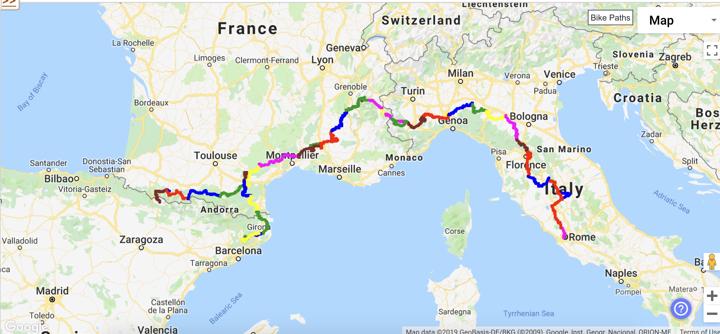


On the Road – Distance: 82km I 51miles I Elevation: 1134m I 3720ft
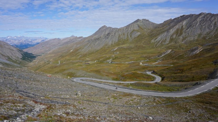
We headed out of our little hamlet towards Col Agnel – it is a long gradual climb but the descent was worth every minute of pain. This is probably the longest descent in Europe! It is again beautiful mountain scenery –quiet villages, beautiful autumnal trees changing colour, and of course the peaks which surrounded us. We crossed border into Italy at 2600 metres (7800 ft) at the summit of Col d’Agnel, which immediately is named Colle dell’Agnello. We then descended for 50 km to our castle hotel in Costigliole Saluzzo. We are now in Italy and will enjoy our pasta tonight!
NOTE: THE VIDEO ENDS AT THE SUMMIT OF COL d’AGNEL BECAUSE SOME GUY FROM EDMONTON SHUT OFF THE RELIVE APP BY ACCIDENT. PHOTOS FOLLOWING THE SUMMIT ARE AT OUR COFFE BREAK, LUNCH AND HOTEL, 50 KM FROM THE SUMMIT.
https://www.relive.cc/view/rt10008229760
Col Agnel (Italian: Colle dell’Agnello)
Col Agnel is in the Cottian Alps, west of Monte Viso between France and Italy which links the Queyras valley (Hautes-Alpes) with Pontechianale in the province of Cuneo, Piedmont. At 2,744 m (9,003 ft), it is the third highest paved road pass of the Alps, after Stelvio Pass and Col de l’Iseran. Agnel has appeared in the Giro three times (’94, ’00, ’07), and in the Tour de France twice (’08, ’11).
Costigliole Saluzzo
Costigliole Saluzzo is a comune (municipality) in the Province of Cuneo in the Italian region Piedmont, located about 60 km (37 mi) southwest of Turin and about 20 km (12 mi) north of Cuneo. Our hotel tonight – Castello Rosso (Red castle) – dates back to the 14th century.
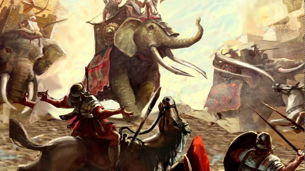
Odyssey Notes: Hannnibal crossing the Alps
The question of where Hannibal crossed the Alps has been debated for centuries, even Napoleon put in a vote for Col Cenis (to the north of our route). Col Agnel is a favourite and even has a plaque claiming it is the route of Hannibal. Whilst we may never definitively know which route he took Col Agnel is certainly one of the most spectacular.
There are no archaeological remains of the crossing (perhaps surprisingly, no one has yet excavated in the Alps looking for evidence) so our guides for our test are literary and well known to Hannibal fans: Polybius and Livy. The problem is that neither writes in much detail about the Alpine crossing – Polybius, for instance, devotes only six pages out of nearly three hundred and fifty in his Rise of the Roman Empire.
Livy devotes about the same quantity, and rather annoyingly seems to have known what pass Hannibal took but doesn’t actually say which one it was. In Book XXI he writes: “I can’t understand why there should be any doubt about the route he [Hannibal] took over the Alps…”. But some academics, like Emilie Emptoz, a Hannibal and Scipio specialist from Grenoble University, think this mystery is what is most compelling about the whole Hannibal story.
Nonetheless, we tried to solve this puzzle every time we ride in the Alps! These criteria are lifted directly out of the descriptions of Hannibal’s crossing in Polybius and Livy so we looked out for these signs!
a big bare or white rock where Hannibal sought refuge with part of his army when he was ambushed by hill tribes
a site suitable for an army to camp, on or near the summit
a spectacular view of Italy from the summit
a descent that is steeper than the ascent
at a high enough altitude to be covered in snow and ice all year round
evidence of a landslide on the descent and burnt rocks where Hannibal forced his way through using fire and vinegar to crack open the rocks blocking his path
pasture on the Italian side after the steep descent
As Hannibal reached the pass’s highest point he gave his men a rousing speech as they looked down on the fertile Po Valley in Italy. His army then took stock and attempted to gather themselves for the coming conflict. Hannibal had lost over 10,000 men crossing the Alps. In October 218BC with 38,000 soldiers and 8,000 cavalry he began the war with Rome on their soil.