Blog

  • Day 26 July 5, 2026 THE LAST DAY OF BIKING- Remagen Loop

    Day 26 July 5, 2026 THE LAST DAY OF BIKING- Remagen Loop 58 miles, 3700’ of elevation gain

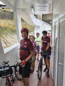
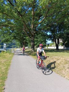
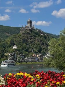
    Today’s ride was often near the tranquil Rhine River. We crossed it on a ferry and road along some of EuroVelo 15’s storied Rhine Cycle Route.
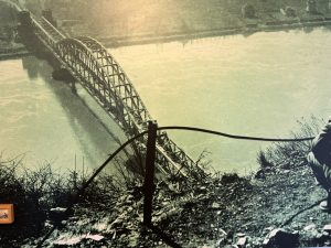
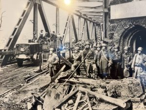
    Our destination was Remagen and the Ludendorff Bridge—a site of dramatic Allied advance in March 1945. It was the only remaining bridge of 19 that crossed the Rhine river in Germany. Here a local guide told us the story of this amazing crossing. The American’s crossing of the Ludendorff Bridge is a dramatic story, one that resulted in hastening the defeat of Germany, in Germany, and the shortening of the war.

    Here is how today’s briefing describes the Race to Remagen. The following detailed information makes today’s blog a bit longer than normal, but it is a fascinating story:

    “Winding its way from Switzerland to the North Sea, the Rhine River has historically stood as a natural barrier defending the German heartland that lies beyond it. Since the days of the Roman Empire, the river’s cold, wide and swift waters have proven to be a formidable obstacle to any aggressor intending to cross it. These facts were well known to the Allied commanders as their forces continued their assault toward the German interior in March 1945. The crossing of the Rhine would be a difficult and costly task.

    As the Allied armies approached, Hitler ordered the destruction of all the bridges that spanned the Rhine. By March 7, they had all been, except one – the Ludendorff railroad bridge at the little resort town of Remagen a few miles to the southeast of Cologne. On that day Lady Luck smiled on the Allies. At about 1 PM an American reconnaissance patrol reached the wooded hills overlooking the river at Remagen, and to their surprise, discovered the bridge still intact. Then the race began.

    The Americans quickly launched a full-scale assault on the bridge while the defending Germans scrambled to detonate the explosive charges that had been set to destroy it. The fighting was fierce as both sides realized what was at stake. The American soldiers scrambled under withering gun fire from girder to girder returning fire and ripping the explosives from the bridge’s super structure. The German’s were successful in detonating some explosives – but not enough to destroy the bridge. By 4 PM – approximately four minutes after the assault began – the Americans had reached the other side of the river and secured the bridge. When informed, 1st Army commander Omar Bradley responded: “Hot dog . . .this will bust ’em wide open. Shove everything you can across!”

    Everett Holles was a NBC Radio war correspondent accompanying the troops that made the assault over the Rhine. He describes what happened as the American force approached the bridge:

    On beyond the four towers of the Apollinariskirche that glistened in a light drizzle of rain they saw Remagen’s 400-yard-long, three-span bridge across the Rhine. The bridge ran to the village of Erpel on the east bank and across it lay two railroad tracks. Other American forces had come up against the same sort of thing before, but always, as they came to the Rhine crossings, the bridges went up in great explosions before their eyes, set off by German demolition engineers.
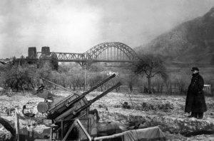
    Traffic was still moving across the Ludendorf Bridge. On the other side locomotives puffed, awaiting orders to pull out. Lt. Col. Leonard Engemann of Minneapolis, in command of a reconnaissance party, was determined to save this bridge if it was at all possible. So, at 3:50 o’clock, a platoon led by Lieut. Emmett Burrows of New York City, sped down the slope to the bridge entrance. There was a flurry of shooting as the Germans, taken completely by surprise, scurried about trying to organize a defense. A German gun was knocked out, some German soldiers killed. Then the Yanks, crouching low against machine gun fire coming from the bridge towers, ran out onto the bridge. Just as they stepped on the span, an explosion occurred three-quarters of the way down the bridge. The Germans were setting off demolition charges, and the men thought surely their chance was gone. But no, only slight damage was done. They raced on.

    Sgt. Alexander A. Drabik, a tall, lanky former butcher from Holland, Ohio, was the first American across the Rhine, the first invader to reach its east bank since the time of Napoleon. But he wanted all the honors passed on to a young lieutenant of the engineers, John W. Mitchell of Pittsburgh.

    “While we were running across the bridge – and, man, it may have been only 250 yards but it seemed like 250 miles to us – I spotted this lieutenant, standing out there completely exposed to the machine gun fire that was pretty heavy by this time. He was cutting wires and kicking the German demolition charges off the bridge with his feet! Boy that took plenty of guts. He’s the one who saved the bridge and made the whole thing possible – the kinda guy I’d like to know.”

    Soon the bridge was swarming with Americans, while Mitchell, joined now by other engineers, cut and jerked out wires leading to dynamite charges. Gingerly they detached detonators and lifted boxes of explosives from the piers.

    Later, from prisoners, the Americans learned that the Germans planned to blow up the span at precisely four o’clock. But the German officer assigned the demolition job was drunk when the American tanks reached Remagen. This officer, a lieutenant, had gone into the town of Eprel as the Yanks approached and spread the word boastfully that ‘the bridge goes up at four o’clock this afternoon’.

    German soldiers and civilians, gathering from miles around, were sitting in ‘grandstand’ seats at every vantage point on the east bank, waiting for the spectacular event to come off, when Burrows’ patrol ran onto the bridge – ten minutes before the hour fixed for its destruction. The German lieutenant signaled the plunger down. Two small explosions occurred, but the bridge only shuddered and remained standing. Several of the fuses had been faulty.

    . . .By nightfall scores of tanks, trucks by the hundreds were moving up and across the Rhine. All roads leading to Remagen were packed with American troops and trucks and armor and guns. Soldiers who had been ready to drop from fatigue stepped on the accelerator, broad grins splitting their begrimed faces. The Ludendorf bridge had become a one-way street, east-bound.”

    The bridge collapsed a couple of weeks after the attempt to blow it up and the hundreds of allied tanks and trucks that crossed it into Germany. All that remains of it today is the girders that once supported it.
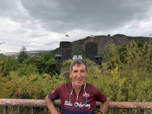
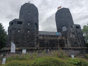
    If you’re interested in watching a movie about this bridge and battle, check out The Bridge at Remagen, a 1969 Movie (https://youtu.be/qb-dUGyv4W0?si=OdxW8w2OcvFHfFUP). It is a somewhat fictionalized version of actual events during the last months of World War II when the 9th Armored Division approached Remagen and captured the intact Ludendorff Bridge. Instead of the real week-long battle and several artillery duels fought between the Americans and German defenders, the film focuses on the heroism and human cost in gaining a bridgehead across the Rhine before the Allies’ final advance into Germany…. worth a watch!
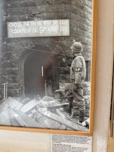
    After marveling at this highly significant and interesting piece of history, we returned through little villages and bike paths to our historic hotel. Thus, a great trip ended. From the Normandy battlefield sites, through WWI and WWII battle sites in France, Belgium, Luxembourg, and Germany, we saw so many interesting places. That is an understatement. This blog only reveals portions of the many beautiful and historical places that we saw.
    A footnote: in the summer of 2013, 13 years ago, I bicycled from Seattle to Washington, D.C. It took 7 weeks to go about 3500 miles. This trip was only 26 days but just as epic in a very different way. I am surely glad that I completed it.
  • Day 25, July 4, 2026 – Lieser to Burg Eltz

    Day 25, July 4, 2026 – Lieser to Burg Eltz, 45 miles

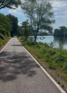
    Today’s ride featured miles of bicycling on bike paths parallel to the Moselle River.

    The riding was very pleasant except for some long, steep hills that we climbed. But those hills also afforded some really nice views.

    The most significant portion of the day is the hotel we are staying at tonight–the Steinberger Grand Hotel and Spa Petersberg. According to the info provided to us, “the Steinberger Grand Hotel and Spa Petersberg has one of the most remarkable guest lists of any hotel in the world, owing to its role as the official guesthouse of West Germany. Since 1954, the hotel has served as the German government’s guest house for state visits, meaning virtually every major world leader passed through its doors during Bonn’s years as the West German capital. From Queen Elizabeth II to the Clintons, Nelson Mandela to Charles DeGaulle! The name “Petersberg” has become an eponym in German diplomacy—it is the setting of the yearly Petersberg Climate Dialogue, and the Petersberg agreement of 1949 that helped reintegrate post war Germany into the Western community of nations was signed here.”

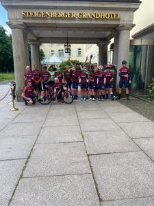
    Now it is housing some intrepid cyclists who bicycled major historical portions of France, Belgium, Luxembourg, and a bit of Germany. They are all very nice, active travelers. Included in that picture are our guides who were excellent.

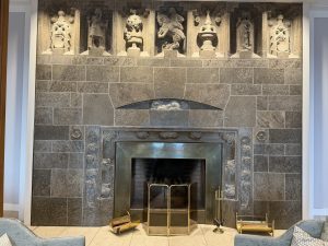
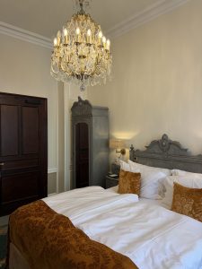
    Although not as ornate as the castle we stayed in yesterday, it is quite nice and apparently more famous.

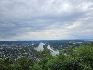
    Perched atop the Siebengebirge ridge overlooking Königswinter and the Rhine. Our grand hotel isn’t just a luxurious retreat—it served as the seat of the Allied High Commission after WWII and later became West Germany’s official guesthouse, often referred to as Germany’s “Camp David”.

  • Friday, July 3, 2026, Day 24 – Trier to Lieser

    Friday, July 3, 2026, Day 24 – Trier to Lieser – 39 miles, 1500’ of elevation gain

    Today’s ride was the easiest of the whole trip. After having biked between 40 and 65 miles a day for the last 20 days, 39 miles seemed easy. Another reason it was easy is because we rode on bike paths along the Moselle River for the majority of the day. A third reason it was easy is because, in contrast to the last few days where we did significant climbing, we only had 1500 feet of elevation gain today.

    Germany’s bike paths are among the best in the world and seem to be everywhere—we saw them in cities, villages, and on both sides of the  Moselle River which begins in France and flows into Germany where it twists sharply for 150 miles and empties into the Rhine on its way to the North Sea.

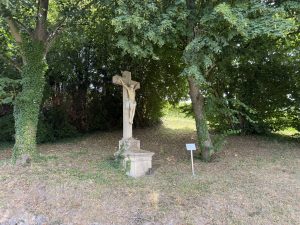
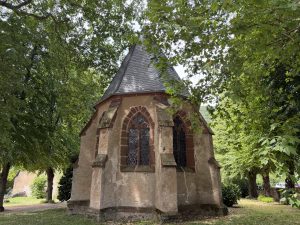
    Like many days before, I saw evidence of the Christian faith on the roadsides, many nice churches and crucifixes.

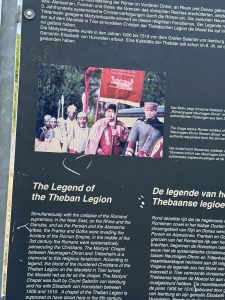
    Yet this area has a history of persecuting Christians as you can see when you zoom in on this roadside panel that I took a picture of.

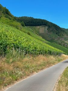
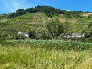
    This region is characterized by winegrowing. Vineyards are everywhere, including on steep hillsides where they get maximum sun exposure. I don’t know one wine from another, but I was interested in seeing the extreme care and ingenuity behind the production of it.

    The area where we traveled is the biggest winegrowing center of the Moselle River region, dedicated mainly to the production of Riesling. I learned that vineyards located on slopes receive even more horizontal sun power than the flat lands. Consequently, about 40% of the vineyard acres in the Mosel are located on steep slopes (at or over a 30% pitch) and the best vineyards typically face south. I am yawning just by writing this paragraph.

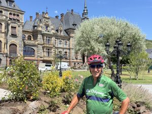
    When we arrived at our final destination, the Village of Lieser, we were all impressed by the stunning castle that we are staying in tonight called the Schloss Lieser.

  • Wednesday, July 2, 2026 Day 23 – Clervaux to Trier

    Wednesday, July 2, 2026 Day 23 – Clervaux to Trier – 56 miles with 3600’ of elevation gain

    After a rigorous climb out of the city of Clervaux we enjoyed a mostly flat ride along the border between Luxembourg and Germany. It was a pleasant ride on the Luxembourg side of the Our River in the Our Valley. The River Our is, like many other rivers in Europe, the natural border between these two countries.

    The roads in Luxembourg are fantastic, likely freshly paved roads with no imperfections on them. Since it is a small, rich country, they pave their roads every two years. Notice how smooth the road is in this picture.

    Our morning coffee break this morning was in the picturesque village of  Vianden, Luxembourg, the hometown of Victor Hugo, the author of “The Hunchback of Notre Dame.” As we entered the village, we saw a magnificent castle on the top of the hill but we didn’t take the time to go to it.

    Soon afterwards, we crossed into Germany and biked along the German side of the Our river on a very pleasant bike path, called the piste cyclable des Trois Rivières through more medieval villages and hamlets.

    Most of the 3600 feet of climbing occurred after lunch with seemingly interminable hills with grades reaching as high as 12%. Finally, after going through a maze of turns, we arrived in the City of Trier, one of Germany’s oldest cities. Trier has an astounding nine UNESCO World Heritage sites.

    A specialized agency of the United Nations, UNESCO stands for United Nations Educational Scientific and Cultural Organization. Started shortly after the end of WWII, it recognizes sites of significant cultural and historical significance. Sites are recognized for their outstanding universal value to humanity, meaning they are considered important not just to the country where they are located, but to all people worldwide.

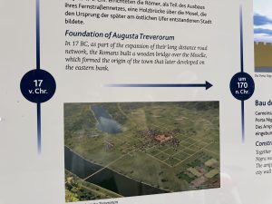
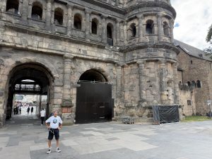
    I didn’t have time to go to all of them, but I did go to Porta Nigra, Trier’s most famous landmark. For you logophiles, Porta Nigra is Latin for “black gate.” It is called Porta Nigra because it has become blackened by time, hence the name. It is a marvel of engineering, since it’s held together by nothing but gravity and iron clamps. Amazingly, the foundation for it was laid in 17 B.C.

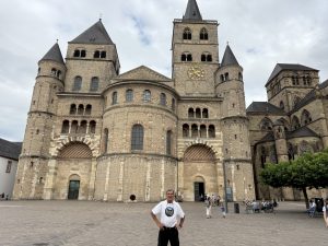
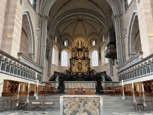
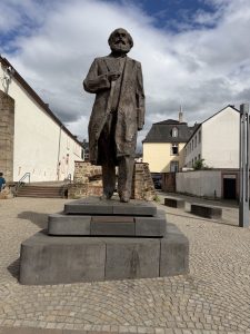
    I also went to a magnificent church, Germany’s oldest Gothic church, and saw a statue of Karl Marx because Trier was his birthplace.

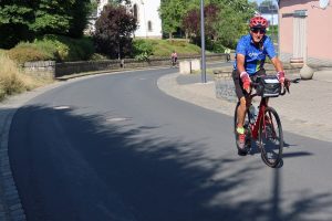
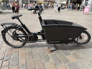
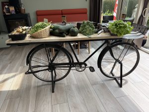
    Much like the rest of Europe, bicycling is a way of life here and people have modified bikes to meet their many needs.


  • Wednesday, July 1, our last rest day

    Wednesday, July 1, our last rest day

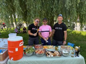
    Today, I will digress a bit from recounting historical information to talking about food. The food supplied by our guides at rest stops has been good and plentiful.

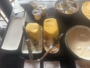
    Meals at restaurants has also been good, even if they have been heavy on vegetables and cheese. At our last hotel stay in Belgium, the staff there were serious about their food. Check out these huge slabs of butter at our breakfast:

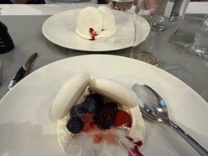
    And last night’s dessert. (Yes, I ate both of them).

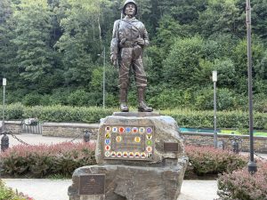
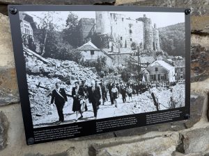
    On our rest day, today, July 1, a local historian from Clervaux took us on a guided tour around his community which was occupied by the Germans during WWII and one of the many battle sites in the Battle of the Bulge. The people here are very appreciative of the Americans who liberated their city as evidenced by this statue of an American GI:

    The war reduced many of the buildings of the community and killed countless civilians but today, it is a beautiful place.

  • Tuesday, June 30, 2026, Day 21 – La Roche-en-Ardennes to Clervaux

    Tuesday, June 30, 2026, Day 21 – La Roche-en-Ardennes to Clervaux – 40 miles, 3600’ of elevation gain

    Today we crossed from Belgium into Luxembourg, our third country on this trip! Although we changed countries, the riding was similar to France and Belgium—mostly quiet roads with many challenging hills.

    Luxembourg has only 600,000 residents in the whole country. Many of its small hamlets were like others we had seen—a church, a cemetery, and a scattering of houses. A major difference between France and Belgium is the quality of its roads. France and Belgium cover up cracks or imperfections in the roads by putting asphalt patches on top of them, resulting in roads that are often quite bumpy. Luxembourg actually repaves their roads, making them nice and smooth.

    Here are some of our views along the way:

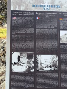
    This is still Battle of the Bulge country-the Ardennes region extends from Belgium into Luxembourg. A little history: The Battle of the Bulge was in response to Hitler’s last attempt to conquer armies and land in order to position Germany for more favorable surrender terms because he knew that the Allies would soon overpower Germany’s forces.

    The German army aimed to push all the way to Antwerp (a major port in Belgium, not an obscure community in Jefferson County, NY) to cut off and destroy the northern Allied forces in a repeat of the stunning 1940 campaign that had collapsed France in six weeks.

    Our tour description for today states, “The assault achieved complete tactical surprise, crashing through thinly held American lines along an 85-mile front, creating a massive westward bulge in the Allied front that gave the battle its name – the crisis reaching its psychological peak at the surrounded town of Bastogne, where the American 101st Airborne Division held a critical road junction against overwhelming German forces, their commander Brigadier General Anthony McAuliffe responding to a German surrender demand with the single word “Nuts” in one of the war’s most celebrated acts of defiant brevity.

    The German advance was ultimately broken by a combination of factors. The fanatical American resistance at Bastogne and dozens of other frozen crossroads and villages, the clearing weather in late December that allowed Allied air power to savage German supply columns and armor, Patton’s extraordinary feat of turning his entire Third Army ninety degrees north in seventy-two hours to relieve Bastogne, and the fundamental German inability to capture the Allied fuel dumps they desperately needed to keep their tanks moving. By late January 1945 the Bulge had been eliminated at a cost of roughly 75,000 American casualties and irreplaceable German losses in men and material that fatally accelerated the final collapse of the Third Reich.”

  • Monday, June 29, Day 20, Dinant to La Roche En Ardenne

    Monday, June 29, Day 20, Dinant to La Roche En Ardenne 46 miles, 3400’ of elevation gain.

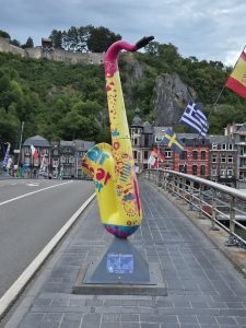
    We started biking today by going through the Village of Dinant which was the home of Adolph Sax who invented the saxophone in the 1840’s.  A bridge crossing the Meuse River is lined with saxophones in recognition of him. Immediately after leaving the village, we went up an enormous hill with a 10% grade for about a mile. Very challenging.

    After that, today’s ride through the Ardennes region of Belgium was quite repetitive. Bike up a steep hill then ride down a steep hill. Bike up a long, gradual hill, then coast down a long, gradual hill. Repeat, then repeat.

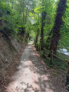
    For about 10 miles, though, we were on a bike path through a wooded area. It was mostly level and a welcome break from the hills:

    The ride was filled with history because forests and river valleys between Dinant and La Roche-en-Ardenne were the epicenter of the Battle of the Bulge – Hitler’s last great offensive gamble, launched on December 16th, 1944, through the same Ardennes forest that had delivered his greatest triumph in 1940.

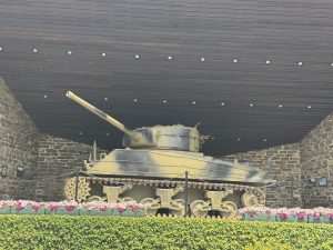
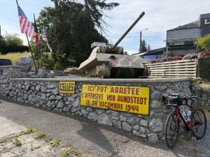
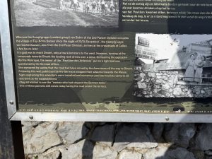
    Along the way, I passed by a tank in the village of Celles.

    What made it even more interesting was the sign describing it. If you look closely at this plaque, you’ll see that a Belgian woman told German tank commanders that the road to Dinant (that the Germans wanted to take) was lined with mines by the Americans. But she lied because the road was not mined. But the Germans believed here and therefore did not go that way, resulting in the village of Dinant being spared.

    The fighting in hills and valleys of this wooded area was among the most savage and intimate of the entire western campaign. Small American units defending crossroads, villages, and river bridges against German armored columns in temperatures of minus twenty degrees Celsius – weapons jamming, rations frozen solid, men succumbing to frostbite in foxholes scraped from iron-hard ground while artillery shells detonated in the forest canopy above them and rained lethal wooden splinters down instead of reaching the earth and La Roche-en-Ardenne itself was taken by German forces and then heavily bombarded by American artillery fighting to retake it.

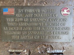
    As you might expect, there were many monuments en route, honoring the men and civilians who died in the war.

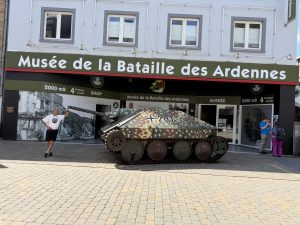
    After today’s ride, I went to the village of La Roche-en-Ardenne to go the Museum of the Battle of the Bulge. The man selling tickets there quickly pointed to a picture on the wall of his father who had fought in the Battle of the Bulge.

    One of my fellow riders asked him what he thought of Americans. With a churlish look he said, “Some good, some bad.” That is because, during the Battle of the Bulge, La Roche-en-Ardenne was held by the Germans. To get the Germans out of the village, the Americans heavily bombed it. As a result, many civilians were killed and much of the ancient city was destroyed.
    In fact, La Roche-en-Ardenne calls itself a martyr city because it took such catastrophic losses in people and property to rid itself of German occupation. Check out this video from the Museum about an American General’s response when the Germans offered him the opportunity to surrender. The first part is in French, but the last part is in clear English.

    By late January 1945 the forests between Dinant and La Roche lay littered with the frozen wreckage of tanks and artillery marking the high-water mark of Hitler’s last gamble.


  • Sunday, June 28, 2026, Day 19 – Mons to Dinant

    Sunday, June 28, 2026, Day 19 – Mons to Dinant – 63 miles, 3000′ elevation gain

    Last night, there was huge thunder and windstorm in Mons. We saw the impact of that today. There were a couple of times that a low spot on the bike path resulted in us having to bicycle through water that was up to our pedals for about 30 feet.

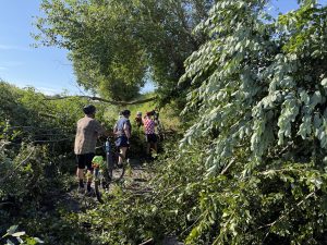
    Our agility was also tested a few times as we had to navigate over fallen trees by someone climbing over them and then handing bicycles over them followed by us riders climbing over or under the fallen trees:

    This area is near where the Battle of Bulge occurred in WWII. The forests and river valleys of the Ardennes between Mons and Dinant was where one of WWII’s most dramatic and strategically decisive moments came when in May 1940 German Panzer divisions drove their armored columns through the supposedly impassable Ardennes forest that French planners had confidently declared tank-proof, crossing the Meuse at Dinant and Sedan in a lightning thrust that cut behind the Allied armies in Belgium and trapped the British Expeditionary Force (BEF) and French forces in a vast encirclement, forcing the Dunkirk evacuation and the fall of France in a campaign of stunning speed.

    At Dinant specifically it was the young tank commander Erwin Rommel, then commanding the 7th Panzer Division with a reckless personal audacity that became legendary, who forced the Meuse crossing under fire on May 13th 1940, personally leading his men across a weir in rubber boats while under intense French fire, his division advancing so fast and so far ahead of its supply lines that it became known as the Ghost Division – moving too quickly for even German headquarters to track its position on the map. It was this crossing that effectively broke open the entire French defensive line and set in motion the chain of catastrophes that collapsed Western Allied resistance within six weeks.

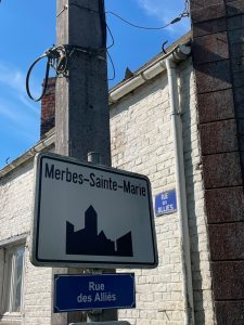
    Fittingly, we traveled along the Rue des Allies:

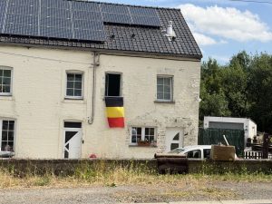
    Over the last few days, I noticed lots of Belgian flags displayed. Maybe that’s due to Belgians having pride in their country. Or, maybe it is due to the fact that Belgium is playing in the World Soccer Cup that is ongoing in the U.S. But since I have zero interest in the World Cup, I am not sure if that is the case. Either way, there are Belgian flags in every little village and town:

    Although we encountered many streets with those uncomfortable cobblestones again today, most of today’s ride was characterized by quiet roads and bike paths. Now I am in Dinant where it is 85 degrees in a nice room except that it lacks air conditioning.

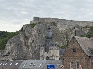
    My view includes a massive rock citadel above Dinant, which has watched invaders cross the river below since the medieval times:


  • Saturday, June 27, Day 18 – Oudenaarde to Mons

    Saturday, June 27, Day 18 – Oudenaarde to Mons – 49 miles, 2100 elevation gain

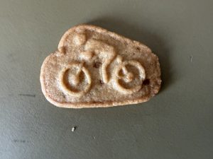
    Yesterday, I mentioned that the bicycling culture is quite evident in this area of Belgium. As further evidence of that, after I wrote the blog, I discovered some bicycle shaped biscuits on the counter in my hotel room.

    For days, we have been seeing areas rich in agriculture. There are field after field of soybeans, corn, onions, cabbage, lettuce, canola, and often grapevines.

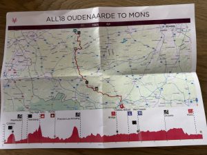
    Today’s ride was rigorous for two reasons. First, was the elevation changes. Collectively, 2100 feet is not bad for a 50-mile ride. But, as you can see from this map of today’s ride, we had two nasty hills where the elevation gain was 18-20%.

    Secondly, was riding on cobblestones. For some reason, the Belgian road makers are fond of cobblestone at intersections and sometimes just on any ordinary road for no apparent reason. Sometimes the cobblestone streets have a paved section to the right of them so riders can avoid the cobblestones. But that is only true about 10% of the time.

    Mons significant in both the Great War and WWII. Interestingly, the British Expeditionary Force fought its first action of WWI at Mons in August 1914, and the war ended with Allied forces re-entering that same city on November 11th 1918 at the moment the guns fell silent, meaning this stretch of Belgian soil witnessed both the opening and closing chapters of Britain’s war.

    At Oudenaarde, Belgian and British troops liberated the city in November 1918, after civilians had been living under German occupation for over four years.

    At Mons itself, the cruelest irony of the entire war played out on the morning of November 11th, 1918. Despite the Armistice being signed at 5:00 a.m. with the ceasefire timed for 11a.m., commanders on both sides continued ordering attacks and advances during those final six hours, knowing the war was over, knowing the minute and hour it would end, and yet sending men forward into fire regardless. Canadian Private George Price was killed by a German sniper at 10:58am, two minutes before the ceasefire and is recorded as the last Commonwealth soldier killed in the war, shot dead within sight of liberation with the Armistice already signed in a railway carriage in Compiègne forest. The sniper who killed him was never identified.

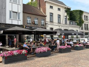
    Although we are still in Belgium this region, called Wallonia, is decidedly French. The road signs have switched from Belgian back to French. Today is a Saturday and the Belgian people are living their lives on the weekend. When we stopped in Ronse for our morning break, I saw a couple of examples of that. First was a big market with items for sale ranging from vegetables to shoes.

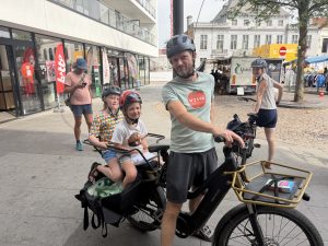
    Next, was a young couple with two children who complimented me on my New Zealand bike jersey. I complimented them on their heavy-duty utilitarian bicycle. The man said that, not only can he pull his two daughters, but he can also bring home a week’s worth of groceries with it.
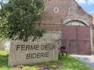
    Another simple but memorable part of the day, and an example of ordinary life in Belgium was our lunch stop. Once we left the bustle of Oudenaarde and Ronse, we were in the sparse countryside with huge fields of bountiful crops, quiet roads, and villages mostly characterized by an intersection with a church, a cemetery, and a small grocery store. The area became so sparse, in fact, that we had our lunch under a tree at a handsome farm with four houses near it, the only houses around for miles:

  • Day 17, June 26, 2026 Ypres to Oudenaarde

    Day 17, June 26, 2026 Ypres to Oudenaarde 47miles 1500’ elevation gain

    I mentioned how hot it was in my room last night and the night before since there was no air conditioning. To compound the heat problem was the noise problem. I left my window open to get a little air in since the 12″ fan in my room was virtually useless. However, right outside my window was a street that the race car drivers seemed to enjoy as the came into town for the car rally. Like juveniles, they enjoyed revving their engines and accelerating greatly before having to brake quickly on the short, narrow street.
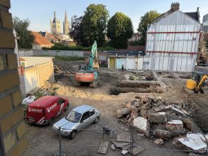
    Then, at about 6:45 a.m. each morning, work with huge machinery and jackhammers began on a huge construction project across the street. If you are ever in Ypres and get a chance to stay at the Albion hotel in the summer, don’t.
    Despite being a bit tired, today’s 47 mile seemed easy despite heat in the low 90s. There were only a few hills, and the scenery was nice once we got out of the busy streets of Ypres.

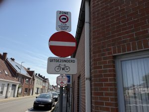
    I mentioned previously that I’m glad I never had to learn to spell Belgian words. Here are a few examples of them:

    This means that cars are not allowed to enter this street but bicycles are.

    In contrast to France where I know many of the words and can usually figure out the meaning by the context, it is much more difficult with the Flemish language.

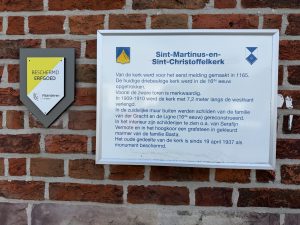
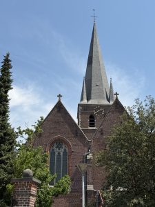
    Like France, most little villages we passed through typically had a nicely built church or cathedral with a nearby cemetery. Instead of a rooster on top of the church like France, Belgian churches have a cross on top of them.

    Oudenaarde is in Flanders and is apparently known for the Tour de Flanders bicycle ride. Much of that ride goes over cobblestones. At many intersections in the villages we passed through, the four-way intersections were filled with cobblestones. They are very rough to ride over but no one fell.

    In contrast to many American hotels, hotels in Europe do not have pools. I am thankful that my hotel room has air conditioning after two days a sauna-like conditions in Ypres. But the AC only works when the card to my room is in a slot located near the door. So, if I go out of my room, the air conditioning stops. (I know, that is a first world problem and a bit of whining).

    The bicycling culture is quite evident here.